Due to Peru’s geographical location and rugged topography, the Peruvian population is exposed to numerous hazards related to recurring phenomena such as landslides, floods, overflows and mudflows. According to the Ministry of the Environment, 67 per cent of disasters in Peru are related to climatic phenomena, causing 5.5 million Peruvians to be exposed to very heavy rainfall. Moreover, structural socioeconomic and urban planning problems make the impacts of flooding more severe and frequent than ever before.
As a result of climate change, retreating glaciers, change in rainy seasons, and pressures on local livelihoods, are also intensifying the risk and impacts of floods. In addition, agricultural land is ruined, infrastructure and basic services are damaged, and transport is restricted due to road closures. This has economic implications at all levels. Peru is also affected by the El Niño phenomenon, which causes major flooding on the Peruvian coast. Although the coastal area represents only 10 per cent of the country’s land, it is home to 54 per cent of the population.
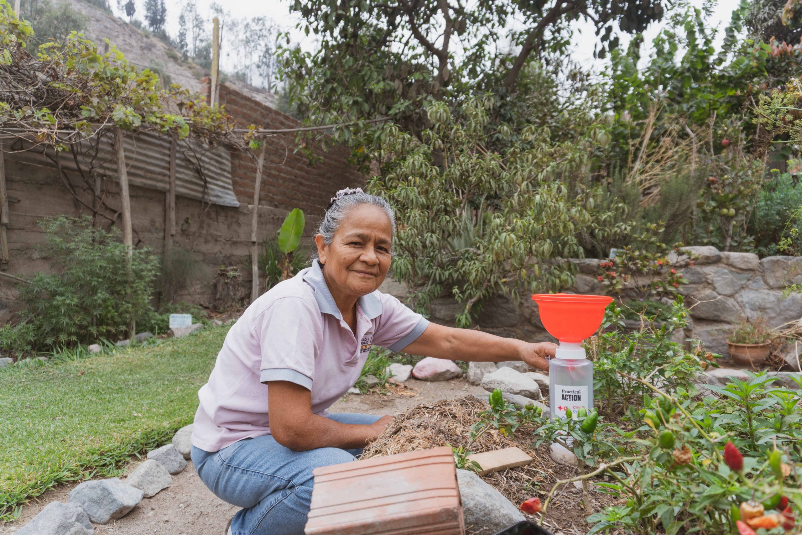
Practical Action is working with communities in the Rimac and Vilcanota river basins to empower them and provide the necessary tools so that people can not only deal with and recover from an emergency, but also manage their own risk. The Rimac basin supplies Lima, the country’s largest city, with water and is where landslides risk disrupting key national transport links. The Vilcanota basin is located in one of the most important areas for tourism and agriculture activities. Many resilience building actions can be taken at community level, as communities often know best when it comes to how and where they need to build resilience. In order to build safer and more resilient communities, Practical Action’s work focuses on three priority topics in Peru: early warning systems, the role of ecosystems in disaster risk management, and governance and investments. By working with these communities, we can demonstrate tangible impact on people’s lives and learn from best practices that can help shape policy at a higher level.
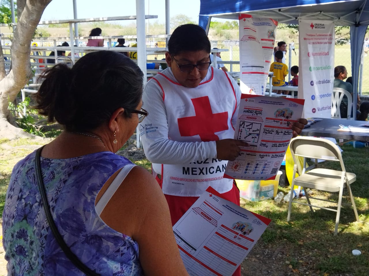
Mexico is susceptible to different types of climate hazards, such as droughts in the desert zone of the north, frosts in the northwest and northeast, heavy rains in the south and tropical cyclones along the coast. According to the National Center for the Prevention of Disasters, around 80% of disaster-related costs in Mexico between 2000 and 2022 were related to hydrometeorological events. The program’s flood resilience work is focused on the most flood-prone areas in Mexico in the Gulf of Mexico region, where the risk of flooding increases during the hurricane season, from May to November each year. Both rapid and slow onset floods in this region consistently lead to damaged infrastructure, loss of lives, displacement of communities, and economic losses. Heatwaves are a common phenomenon in Mexico during the summer months however, according to the National Water Commission, most parts of Mexico have experienced higher-than-average temperatures due to climate change. The program is working with communities exposed to extreme heat in the northwest region.
The program works with local populations to strengthen flood resilience at a household and community level, implementing interventions such as the formation of community brigades, the development of family emergency plans and risk awareness through community resilience fairs, among others. In both rural and urban contexts, the Mexican Red Cross facilitates integration and collaboration with diverse sectors including health, education, universities and civil protection. The knowledge and experience gained is shared with communities, practitioners, and policy makers and used as evidence to advocate for better laws, policies, and plans.
Bolivia experiences many different hazards, with floods, fires, droughts and frost being the most frequent. According to data from the National Institute of Statistics, the number of adverse events in Bolivia doubled between 2014 and 2022. While 2014 was presented with a record-breaking number of floods (100 registered events), 42 flood events were registered in 2022. In contrast, 4 forest fire events were recorded in 2014, whereas 145 fires were seen in 2022.
According to Wildlife Conservation Society in Bolivia, changes in humidity, prolonged and extreme dry periods, increased wind intensity, more intense but shorter periods of precipitation, all contribute to the occurrence and intensification of fires as more combustible material is generated under these conditions. Traditional practices, such as the use of fire to manage pastures for livestock, combined with these conditions are leading to more frequent, widespread and intensified wildfires affecting mainly indigenous territories.
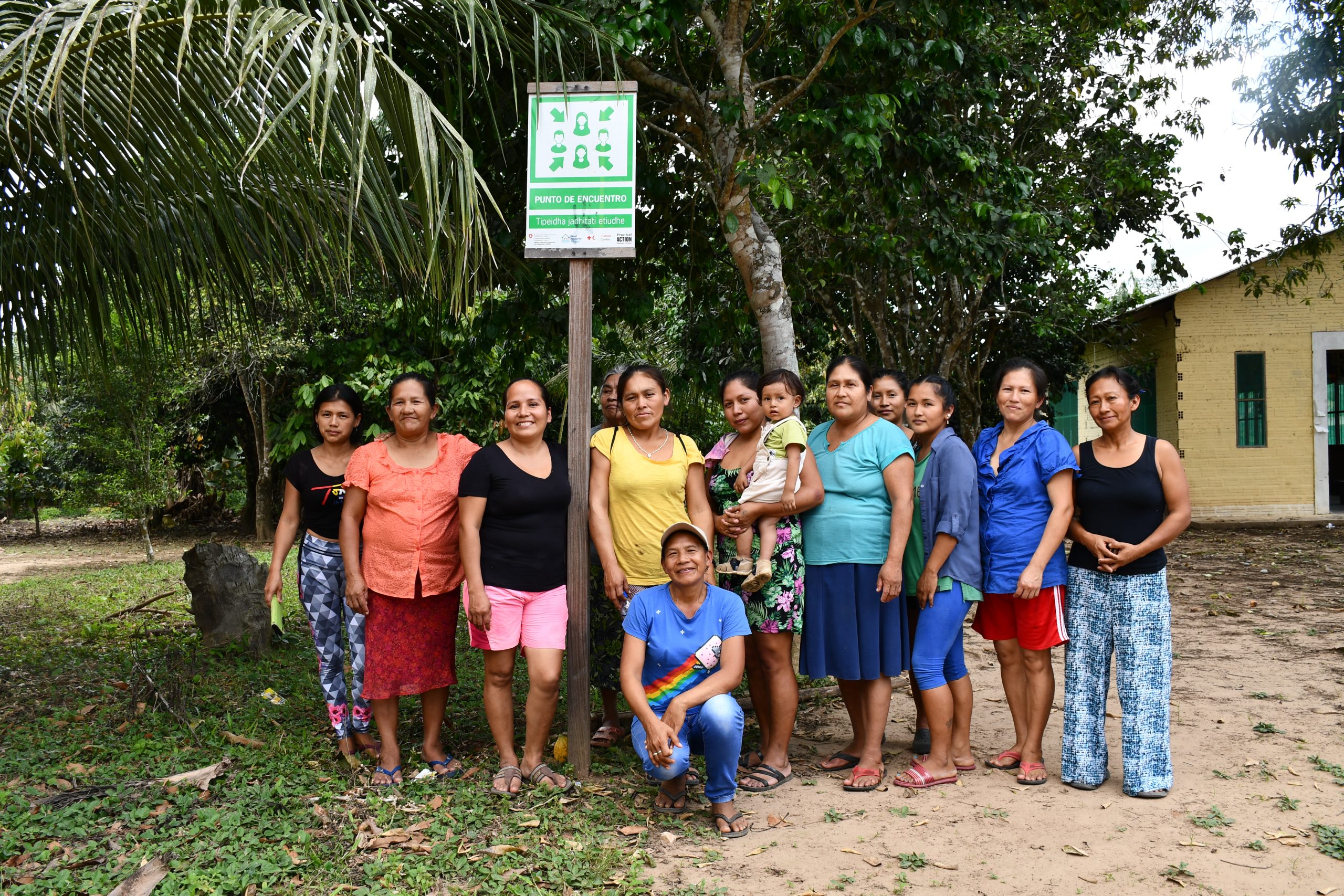
Practical Action is working in rural and urban communities across Bolivia to strengthen resilience at the community level, with a focus on climate resilience, disaster risk management, sustainable agriculture, water and sanitation, and access to energy. Up to 2024, Practical Action’s work focused on flood resilience in the Rurrenabaque, San Buenaventura and Mecapaca municipalities. As a result, vulnerable populations in the Beni/Mamore and La Paz river basins are increasing their resilience towards regular flood events.
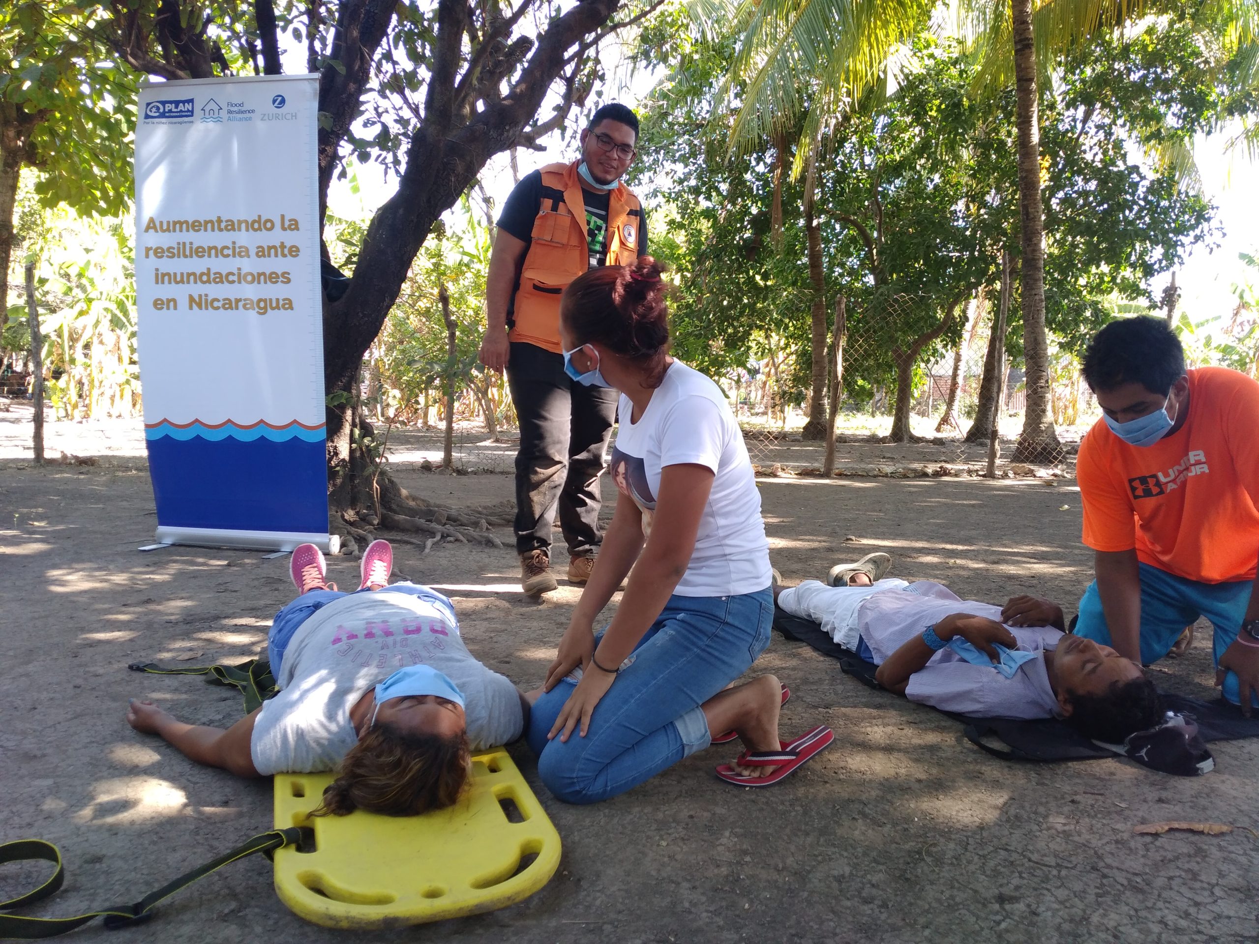
Nicaragua ranks as the country fourth most vulnerable to flooding and other natural hazards globally. This already high level of vulnerability is increasing in magnitude due to changing weather patterns as a result of climate change. Floods cause severe impacts on people’s livelihoods in rural and urban communities and indirect damage to the production of goods and services, resulting in a decline in Nicaragua’s national economy. The most recent flood in the communities where Plan works occurred in October 2018. In the event of a flood, affected communities are engulfed by streams of water, sand, soil, and collapsed trees. Colossal landslides can be triggered on the slopes of the country’s many volcanoes and hills, ruining roads, and bridges.
Plan worked with approximately 1,500 direct and 2,750 indirect beneficiaries in four communities in the municipality of El Viejo, department of Chinandega. Based on information provided by the Disaster Risk Management (DRM) unit in the municipality, these four communities were identified as being areas affected by annual floods, particularly over the past decade.
Throughout the project, Plan was also an implementing partner of the government in DRM and in climate change adaptation and mitigation measures at the local and municipal level. As Plan is a children’s rights organization with key expertise in gender equality, community development projects with children and adolescents were at the heart of its work in Nicaragua. Together with local partner organizations, a number of different activities were carried out in their communities of intervention. These included founding community response committees and training them in first aid and evacuation techniques; developing communal risk response maps; and constructing and signalling evacuation routes. Plan also supported small-scale infrastructure projects so that local assets are better protected in the event of a flood.

El Salvador is highly vulnerable to natural hazards; with 89 per cent of the country at risk of flooding or other natural hazards. This high level of vulnerability is exacerbated by the high frequency of extreme weather conditions as a result of climate change. Historically, El Salvador has faced many emergency situations due to tectonic, volcanic, and hydrometeorological activity. Due to their frequent occurrence, earthquakes and floods have caused the most losses in terms of lives and material goods.
In El Salvador, many rural communities live in areas prone to flooding. Flood has also increased in urban communities located along lower river basins. Accelerated population growth, absence of river drainage systems, and poor infrastructure conditions are some of the root causes of this vulnerability to flooding. In the event of a flood, affected communities are engulfed by streams of water, sand, soil and collapsed trees.
As a member of the Alliance, Plan International currently works in four communities: San Diego and El Majahual in the municipality of La Libertad, Santa Bárbara in the municipality of Chalatenango, and Colima in the municipality of Cuscatlán. In these communities, Plan works directly with approximately 840 adults, 850 adolescents, and 710 children. These communities were chosen due to their economic vulnerability and their proximity to flood-prone areas. San Diego, Bocana and El Majahual are located on the Pacific coast and are highly exposed to the threat of tsunamis. Colima and Santa Bárbara are located next to the Cerrón Grande reservoir which, after heavy rainfall, floods and transport riverbed sediments to surrounding homes.


